|
|

|
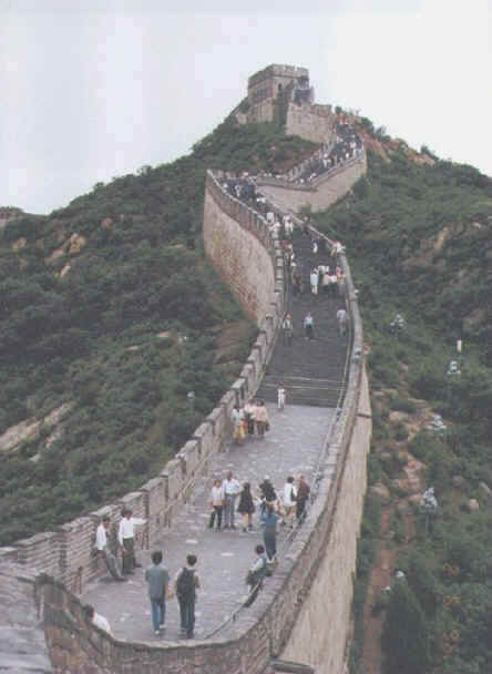
| Great Wall of China -- Galen Frysinger Photo |
Asia is the world's largest
continent, at just over 17 million square miles. The population of approximately 3.3 billion people, is nearly
three fifths of the world's total population.
Asia and Europe form a continuous landmass -- sometime called
Eurasia. It is convenient to distinguish the two landmasses into differing continents because of the vast cultural differences
between the two. The 'boundary' between the landmasses lies approximately along the Urals, the Ural River, the
Caspian Sea, the Caucasus, the Black Sea, the Bosporus and Dardanelles straits, and the Aegean Sea. The land connection of
Asia with Africa is through the isthmus oof Suez. Asia comes with a little more than 50 miles of North America at the Bering
Strait. Water surrounding Asia includes the Gulf of Aden, the Arabian Sea, and the Bay of Bengal on the south;
the South China Sea, East China Sea, Yellow Sea, Sea of Japan, Sea of Okhotsk, and Bering Sea on the east; and to the north
by the Arctic Ocean.
The continent of Asia consists of Precambrian rock
structures -- the Arabian and Indian peninsulas in the south and the central Siberian plateau in the north, this rock
mass enclosed a zone of folded ridges caused by the collision of Europe and Asia during the assemblance of Pangaea.
Asia is divided into the physiographic provinces of: the Northern Lowlands which cover west central Asia and most
of Siberia; the huge Central Highland of high plateaus, rising to15,000 feet in Tibet in China and enclosed by
some of the world's greatest mountain ranges -- the Himalayas, the Karakorum, the Kunlun Shan, the Tian Shan, and the
Hindu Kush; India and Arabia are plateaus that adjoin the valleys of the Indus and Ganges Rivers. Mt. Everest at 29,035
along the Nepal/Tibet border is the world's highest peak; in contrast, the shores of the Dead Sea at 1,312 feet below
sea level is the world's lowest point on land. Mountains from the mainland extend southeastwasrd forming penisulas in
South East Asia -- eventually reappearing as the islands to the south of the mainland. Asia's rivers number among the
longest in the world, they rise in the high plateaus and mountains and have deposited sediment to form the heavily populated
alluvial lowlands of Asia. They include the Ob-Irtysh, the Yenisei, and Lena of Siberia; the Amur, Huang He (aka Yellow),
Chang (Yangtze), Xi (West River), Mekong, Salween, and Irrawaddy of east and southeast Asia; the Ganges-Brahmaputra
of eastern India and Bangladesh, the Indus of Pakistan, and Tigris-Euphrates of Iraq. Central Asia has vast areas of interior
drainage terminating in the Aral Sea and Lake Balkash. Climatically, the continent ranges through all climate zones, from Tropical
Rainforest near the equator to Tundra along the arctic coast. Monsoon rains affect both east, southeast, and east Asia --
interior locations experience the extreme of aridity.
Most of the people of Asia live on the great alluvial plains
of the rivers -- depending for their very lives on the fertile soil and monsoon rains. Many people depend on hunting
and fishing in the northern part of Asia -- in the central and southwestern regions nomadic herding is the main activity. In
the Humid Subtropical climate zone, rice is the most important crop -- in some areas, 2 or more crops per year. Rice
is the heaviest yielding grain of all -- almost all of it grown with hand labor. Farmland is extremely limited by climate
and landscape. Other important crops of the region include wheat and soybeans in cooler climates to the north, peanuts,
sugarcane, cotton, jute, silk, rubber, tea and coconuts.
Japan is the industrial giant of Asia -- China, South Korea,
Taiwan, Turkey, and Israel are considered among the industrialized countries as well.
Exports from the region include petroleum from Indonesia,
tin from Malaysia, Thailand, and Indonesia, India exports manganese, chromite from Turkey and the Philippines. China
produces tungsten, antimony, coal, and oil. Huge oil deposits are believed to underly the South China Sea.
Geography 101 -- East Asia
Geography 101 -- Southeast Asia
Geography 101 -- South Asia
Asia -- Infoplease
CIA World Factbook
Animated Climate Map
Weather Satellite
Map and Discussion
Outline of Asian History
Galen Frysinger Photos
Tour of Southern and Eastern China
Monsoons
|
|
|