In the 19th Century Africa became the focus of European colonial
expansion. The coasts were well known and visited often following the voyage of Vasco de Gama, the interior was not.
Henry M. Stanley's trek across Africa 1874--1877 was the first serious attempt at exploring the interior of the continent.
The Sahara to the north, steep escarpments along the coasts, and the efforts of slave traders to keep their source of slaves
secret all contributed to the long lag between coastal and interior exploration.
The division of Africa by European powers took place in the
late 19th century. Since that time the countries of Africa have become independant -- some far more prepared for self
government than others. The problems of most African countries are enormous and natural disasters such as drought in
some areas has only worsened a bad situation. Most Africans are extremely poor, they desire better supplies of food, houses,
hospital and schools, rather than the export of minerals and plantation crops to the developed world.
AIDS has taken a tremendous toll on the African population
in addition to the existing problems.
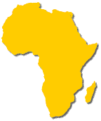
Sub-Saharan Africa (SSA) lies astride the equator and occupies
all areas south of the Sahara. Africa is a plateau like continent, there are no continuous ranges of mountains as seen
on other continents -- the climatic pattern is therefore simplified. Escarpments are found all around Africa except
in the west -- these cliffs were produced as Pangaea broke up and its component parts drifted away.
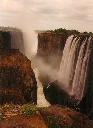
Wherever rivers cross this feature are waterfalls and rapids
which did not encourage travel deeper into the interior.
Africa continues to break apart. The Great Rift Valley
of eastern Africa is a land of mountains and valleys produced by rifting, and continues to break Africa into new sections.
The Great Lakes of Africa occupy downfaulted basins within the Eastern Highlands. Africa's highest mountains peaks are
volcanoes within this geologic regime.
From the deserts of north Africa, climate grades into Steppe,
then Tropical Savanna -- the tropical wet and dry depending on convectional summer thunderstorms as it source of moisture.
In the central part and western parts near the equator Rainforest climate prevails with ITC rains almost all year long.
South of the Rainforest the pattern of Savanna, Steppe and Desert is repeated. A small area of southwestern Africa has
Mediterranean climate, and in the southeast a climate resembling a Subtropical/Marine combination.
Agriculture is limited. Some areas have too much rain,
others insufficient amounts. Insects and disease are major factors in livestock production in many areas. Most
of Africa's 570 million people are subsistence farmers. Many are leaving the rural areas for the cities and ubanization
is occuring rapidly. Most African countries depend on the export of one to two crops or commodities -- usually to the
former Euopean colonial power that ruled them.
Mineral wealth is of tremendous proportion -- copper, gold,
rare earth metals, petroleum and diamonds are of worldwide importance. A large part of southeastern Africa is a section
of the Gondwanaland Shield -- ancient rock that contains metal ores and old volcanic areas where diamonds are mined.
Industrialization in any great amount has yet to arrive in
most of SSA. South Africa is the most industrialized country on the entire continent and builds many of the products
it needs from railroad locomotive to aircraft.