M&R Geography-Geology
Australia New Zealand and Oceania


Home | Maps and Map Reading | Geographer's View of the World | The Physical Earth | Weather & Climate | People on Earth | Resources and Land Use | United States | Canada | Latin America | Europe | Russia and the Former Soviet Republics | North Africa & Southwest Asia | Africa South of the Sahara | Asia | Australia New Zealand and Oceania | Physical Geology Course Online | Mike's GeoWorld | GeoT Geography | Illinois Landscapes


globe3_opt.gif

australiaclip.gif

ausmall.gif
Australia

koalaphoto.jpg

ayresrockgf.jpg
View from Ayre's Rock -- Galen Frysinger Photo

nzsmall.gif
New Zealand

National Anthems

Australia
 
The lands of the South Pacific ocean are the most remote on earth.  They were the last to be discovered and colonized by the Europeans. 
 
People have inhabited these lands for a great length of time -- possibly migrating across land bridges and navigating short stretches of water during the last Ice Age when sea levels were lower and much more land in this region exposed.  When the Ice Age concluded, sea levels rose prohibiting a return to the main landmass of Asia.  As a result, some of the most unique plants and animals on earth have developed in this region -- especially in Australia.
 
Australia was long thought to exist before its actual discovery -- the ancient Greeks suggested a great southland on the opposite side of the earth.  The continent was 'discovered' several times, but not until the voyage of Capt. James Cook was favorable land found where settlement appeared encouraging -- this was on Australia's eastern coast in a zone of Subtropical climate.
 
Australia is the driest of all the inhabited continents -- lying in a belt of subtropical high pressure -- most of the continent is desert or semi-desert.  The deserts of Australia are unique in that there is no major river which flows across them -- all the other deserts of the world have at least one.  In eastern Australia is a zone of Subtropical climate with onshore winds from the Pacific and forest lands in the Great Dividing Range mountains.  Southeastern Australia and Tasmania are considered Marine.  There are zones of Mediterranean climate in the southwest and south, and a tropical monsoon zone in the far north.
 
The basin of the Murray-Darling River system is a tall prairie grassland which became a great area for the production of sheep.  Wells drilled into the lowland west of the Great Dividing Range discovered a huge underground water resource -- the Great Artesian Basin.  The availability of water has turned this region into a huge area for the production of cattle and sheep.  Additional pasture lands are in Western Australia, near Perth and northward.  Owing to the dry climate, wheat is a major crop and is generally grown in the same areas as sheep.  Exports of wool, mutton, beef, dairy, and wheat are sent around the world.  The coastlands of Queensland are suited to the production of sugarcane.
 
Mineral resource include coal, iron, lead, zinc, and copper.  Gold is among the reasons for many people to immigrate to Australia in the mid 1800's.  Manufacturing using these resources is somewhat limited by the small population and great distance to other markets -- many of the resources are exported -- especially to Japan.
 
Australia is a progressive and prosperous country with standards of living among the highest in the world.  Most Australians live in or near the Capital cites of each state -- with most living in the eastern and southeastern parts of the country.

southernalps.jpg
Southern Alps New Zealand -- Galen Frysinger Photo

New Zealand
 

New Zealand is located about 1,200 miles southeast of Australia across the Tasman Sea. New Zealand consists of two main islands produced at a boundary between the Pacific and Australian tectonic plates. North Island contains most of the people and cites and has volcanic and hot water geologic features. South Island is the larger of the two main islands, and is home to the spectacular Southern Alps mountain range.  The county is located in the zone of westerly onshore winds that produce a Marine climate over most of the country.  Climate becomes somewhat more Subtropical in a northward direction on North Island.  Glaciers are found in the mountains of South Island.

Most of the larger cities are in the coastal areas of North Island and the downwind somewhat drier eastern side of South Island. 

Australia and New Zealand do share some similaries -- sheep and agricultural products are important industries in both countries. New Zealand is a a major exporter of mutton, lamb, butter, cheese, wool and beef.  Most manufactured goods are imported owing to the small population and lack of mineral  resources.

New Zealand is considered part of Polynesia -- the original inhabitants, the Maori make up only 10% of the population.  Settlement by the British was in many ways similar to that of Australia.

The Maoris arrived in New Zealand around 1000 CE.  Maori tradition states that they came to the islands in 7 canoes from other parts of Polynesia.  In 1642, Dutch navigator Abel Tasman explored New Zealand.  British captain James Cook made three voyages to the islands, beginning in 1769 and Britain formally annexed the islands in 1840.

marquesasisland.jpg
Marquesas Island -- Galen Frysinger Photo

Oceania
 
This region is a vast area of the Pacific containing thousands of islands, islets, and reefs nearly at sea level.  Most of the islands are in the southwest Pacific, leaving much of the region empty ocean.  Like Austalia and New Zealand, the first inhabitants here came from Asia via land bridges and short traverses of water bodies during the Ice Age.
 
The region is commonly divided into 3 areas based on different people and different ways of living.
 
Melanesia  --  includes the islands north and northeast Australia from
                      New Guinea to New Caledonia.
Micronesia  -- includes islands north of the equator and west of 180 longitude.
Polynesia  --  makes up the remainder of the islands of the Pacific
                      from to New Zealand.
 
At one time this region was considered a Paradise -- and it came very close to being that until Europeans and a World War came along.  Those events changed everything for the indigenous population.  Until those times, the people lived in isolation and self-sufficiency.
 
The vast expanse of ocean is the dominant factor here -- keeping temperatures moderate even though parts of the region are in the tropics.
Trade winds blow from the east on both sides of the equator and collide causing heavy rainfall over most of the region.  Typhoons are a threat in the late summer and fall.  Typhoons are more common north of the equator, cross Micronesia to the Philippines, and sometimes on the the coast of Asia.
 
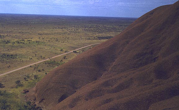
The islands of the Pacific are of Continental, Volcanic, and Coral origin.
 
Continental Islands  --  these are actually the tops of submerged mountain
                                    ranges formed along plate boundaries.
Volcanic Islands      --  these too are near plate boundaries where
                                    subducted rock melts and returns to the surface
                                    as a volcano and may form an island.
Coral Islands           --   these islands are built by lime-secreting polyps just
                                     below sea level on the flanks of small
                                     volcanoes.   Often, the volcano erodes away 
                                     leaving a ring-shaped island called an atoll. 
 
Melanesia was discovered by the Europeans and soon became the site of  agriculture in non-traditional ways.  Europeans introduced commercial farming, and plantations of sugarcane and copra were created to supply the European market.  Some mining of metal ore mineals does occur.  Copper is found on Bougainville island, nickel in New Caledonia, and gold and oil in Papua New Guinea.
 
Micronesia consists largely of coral atolls -- very low, and some barely above sea level.  This is the realm of the outrigger canoe people used to go from island to island looking for food.  Fish and coconuts are the mainstay of the people living here.  Today, copra is the major export.  Phosphate rock has been an important export of Nauru.
 
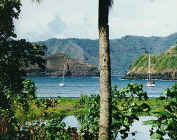
Polynesia occupies the eastern part of the region.  People here are very similar in language and culture.  Sugarcane plantations occupy some of the larger islands.      


Geography 101 -- Australia & New Zealand

Geography 101 -- Pacific Islands

Australia -- Infoplease

New Zealand -- Infoplease

Oceania -- Infoplease

CIA World Factbook

Animated Climate Map

Weather Satellite

Nighttime Lights of Australia

Listen Live to Radio Australia

The Great Artesian Basin

The Great Dividing Range

Galen Frysinger Photos

Photos Near Brisbane

Guide to Australia -- Geography of Each State

Towns & Cities

Rabbits in Australia

Dingoes

Ayers Rock

Devil's Marbles -- Northern Territory

Virtual Australia -- Photos

Map and Discussion

Virtual New Zealand


M&R Geography-Geology