M&R Geography-Geology
United States


Home | Maps and Map Reading | Geographer's View of the World | The Physical Earth | Weather & Climate | People on Earth | Resources and Land Use | United States | Canada | Latin America | Europe | Russia and the Former Soviet Republics | North Africa & Southwest Asia | Africa South of the Sahara | Asia | Australia New Zealand and Oceania | Physical Geology Course Online | Mike's GeoWorld | GeoT Geography | Illinois Landscapes


globe3_opt.gif

usflagb.gif

91120ribbon.gif

usainfared.gif

USGS Photo

chicagoskyline2.jpg
Chicago -- Galen Frysinger Photo

The United States is a land of great variety -- many different landforms and climate zones.  What cannot be found or grown one place most likely can be somewhere else.  The United States has profited from all of this with a vision toward developing these resources and providing economic mechanisms and incentives to see that it happened.
 
In doing so, the United States has become a model for the world.
 
Several factors contribute to this success -- A land rich in resources, a hard working and creative population, development of transportation and communication links, and a democratic government.
 
Perhaps the greatest asset of the United States is its soil and agricultural resources -- this is a country capable of feeding itself and much of the world.  Vast forest lands provided materials to the early settlers and continue to do so today.  Mineral wealth is abundant -- both in metal ores and fuels.
 
Development of transportation systems allowed all of these commodities to move to locations of need.  Whether by river and canal, railroad, road, or air, transportation is critical to the development of an economy.  Tremendous challenges of such a wide a diverse terrain were overcome with ingenuity for the benefit of all.
 
Communication systems allow the transmission of data and ideas -- from the initial telegraph to satellite communications, the United States has been a world leader.
 
These things were propelled by the democratic concept of recognition of individual achievement within the capitalist economic system.

Comprehensive Data -- United States of America

Atlas of U.S. States

State Nicknames

Information for all 50 States

Test Your Knowledge of the United States

Map and Discussion

Physiographic Regions of the United States

Galen Frysinger Photos

John Donohue's National Park Photos and Links

Geology of the Grand Canyon


Climates of the United States

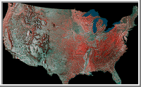
The United States has the entire range of climate -- ranging from Tropical Rainforest (Hawaii) to Polar Ice Cap (Highest Mountains).
 
The US has a great range of latitude, and is affected by serveral different source regions of airmasses -- explaining why the great variety of climates exist.
 
The northeastern United States has a Humind Continental climate.  This climate reflects the heating/cooling characteristics of interior landmasses.  Summers are hot and winters are cold -- modified by extremes of latitude within the zone -- cooler/colder to the north; warmer/milder to the south.  Precipitation thoughout the zone is adequate for agricultural endeavors, ranging from 40 + in the south and east to 20 inches in the north.
 
The Humid Continental climate is gradational to the Humid Subtropical climate of the southeast.  Due to the lower latitude, the southeastern region experiences warmer/longer summers and shorter/milder winters.
Precipitation is adequate for agriculture.
 
Both the Continental and Subtropical climates grade rather abruptly to Steppe climate near 100 degrees west longitude.  Here, storms from  the Gulf of Mexico turn eastward leaving most of the Great Plains in the rainshadow of the Rocky Mountains.
 
Deserts are found in parts of the west and southwest -- due to the combination of rainshadow affect and subtropical high pressure.
 
The Mediterranean Climate of southern California is caused by an alternating wind and pressure system.  In the summer months subtropical high pressure caps the region -- precluding any significant rainfall. Irrigation of crops is mandatory.  In the winter months, the high pressure retreats south, following the direct rays of the sun, and westerlie wind flow brings rain.
 
To the north of the Mediterranean zone climate grades into Marine West Coast.   Seldom hot and seldom cold, this climate reflects the moderating influence of the ocean.  Water is slow to heat and slow to cool -- the warmth of summer is held well into the winter months, and the cool of winter well into the summer months -- moderating seasonal temperatures.  Marine climate extends northward into the southern parts of Alaska.  Abundant rainfall grows huge forests -- especially in mountain areas.
 
Subarctic climate is found over most of Alaska -- this climate can be suprizingly warm in the summer due to the long hours of sunlight -- but bitterly cold in the winter. Precipitation is adequate for the growth of forests.
 
Tundra climate is found along the northern coast of Alaska -- a short cool summer and long cold winters preclude the growth of trees.
 
Within the mountain areas climate varies by alititude -- higher colder -- and by wind direction.  Ascending air masses produce precipitation on the windward side of the mountain, but then warm and dry the land as they descend the lee side.  Rainshadows are commonly found downwind of mountains.

Geography 101 -- North America

United States -- Infoplease

CIA World Factbook

Animated Climatic Factors Maps -- Including a link to Koeppen's Climate Map

Precipitation Pattern of North America

Vegetation Zones of North America

Climatic Data -- 50 States

United States Weather Radar

Physiographic Provinces of the United States

Atlantic Coastal Plain Province

Appalachian Highlands Province

Interior Plains Province

Laurentian Upland: Superior Province

Ozark-Ouachita Province

Rocky Mountain Province

Colorado Plateau Province

Basin and Range Province

Columbia Plateau Province

Pacific Mountain System Province


The variety of land surfaces and climate zones afford a great deal of possibilities of useable land.  The link below presents a synopsis of land use for a multitude of areas in the U.S.  It also includes information on topography and elevation, climate, soils, water, and possible natural vegetation.

Major Land Use of the United States

United States Agriculture

Agricultural Atlas of the United States

Information -- Livestock & Crops

Breeds of Livestock

Information -- US Dept of Agriculture - Natural Resources Conservation Service

United States Forest Resources

Map of U.S. National Forests

Forest Facts

Fishing Resources

Discussion US Fishing Industy

Minerals and Mining

Petroleum and Gas

Coal

Iron

Copper

Lead and Zinc

Soil

Transportation

icsd70s.jpg

Transportation Density Map

Mississippi River Transportation

Great Lakes Transportation

Leading U.S. Seaports

Railroads

Trucks

Interstate Highway System

Air Transportation

Navigate to Information -- 50 States

Roadside America

Canada